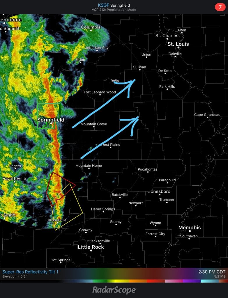
The National Weather Service released this photo of the direction of winds, headed toward Oakville, top right.
A tornado watch in in effect through midnight Tuesday for St. Louis County and the surrounding region, with wind gusts up to 75 mph likely.
The NWS of St. Louis says that a few tornadoes are likely in the affected area, which spreads from Sedalia to as far east as Centralia, Illinois and as south as Poplar Bluff and Carbondale, Illinois.
The area includes a population of more than 4 million people, 1,581 schools and 113 hospitals.
According to maps posted by the National Weather Service, the line of wind will push into the area from Springfield across Missouri headed toward Oakville.
The areas most at risk for tornadoes are in the middle part of the state and the area around St. Louis, with the worst of the storm hitting between 6 and 9 p.m.


