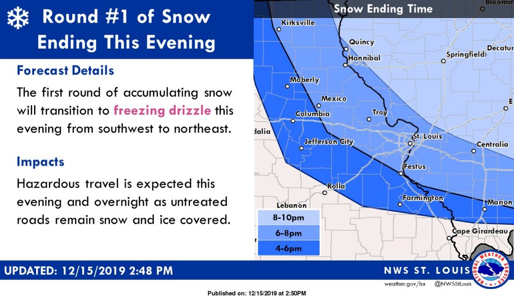


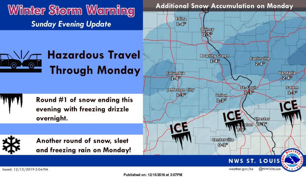
A winter storm warning is in effect from now through Tuesday morning, with a possible 5-8 inches of snow and some ice expected to make roads difficult to travel.
Heavy mixed — snow and ice — precipitation is expected, with the National Weather Service projecting 5 to 8 inches of snow and ice accumulations up to 1 inch. The storm is expected to bring snow and ice to most of Missouri.
The blast of winter weather will hit not just St. Louis, but central, east central and northeast Missouri.
The advisory went into effect at 9 a.m. Sunday and will end at midnight Tuesday morning.
The first gusts of snow Sunday will transition to freezing drizzle Sunday evening. Another round of snow, sleet and freezing rain will arrive Monday, forecasters project.
The St. Louis County Office of Emergency Management cautions that travel could be very difficult, and the hazardous conditions could affect the Monday morning and evening commutes.
Snowfall rates could exceed 1 inch an hour at times. Strong winds are also possible.
Temperatures will stay in the upper 20s Sunday and Sunday night, which will help snow accumulate faster, especially on untreated roads, bridges and overpasses.
The Missouri Department of Transportation is urging residents to delay travel Monday morning if possible due to the ice accumulation expected.
MoDOT workers are treating roads and bridges in advance of the storm, and drivers are urged to keep informed of the rapidly changing forecast.
Anyone who has to travel is urged to use “extreme caution” and begin with a full tank of gas and a winter storm kit — a shovel, flashlight, cell phone, food, water and blankets or extra warm clothing.
The latest road conditions can be obtained on the Internet at traveler.modot.org/map/ or by calling 1-888-275-6636.
Affected areas for the winter storm warning include St. Louis County, St. Louis city, and the following counties: Jefferson, St. Charles, Lincoln, Franklin, Monroe, Moniteau, Pike, Cole, Warren, Audrain, Gasconade, Boone, Callaway, Montgomery, Osage, Ralls.
A winter storm watch is in effect through midnight Tuesday morning in additional counties, including Bond, Calhoun, Greene, Washington, St. Clair, Madison, Clinton, Marion, Macoupin, Fayette and Jersey counties. Those areas could receive 2 to 6 inches of snow and ice accumulations up to a tench of an inch.
Unlike a warning, a winter storm watch does not mean that the anticipated weather is a certainty.